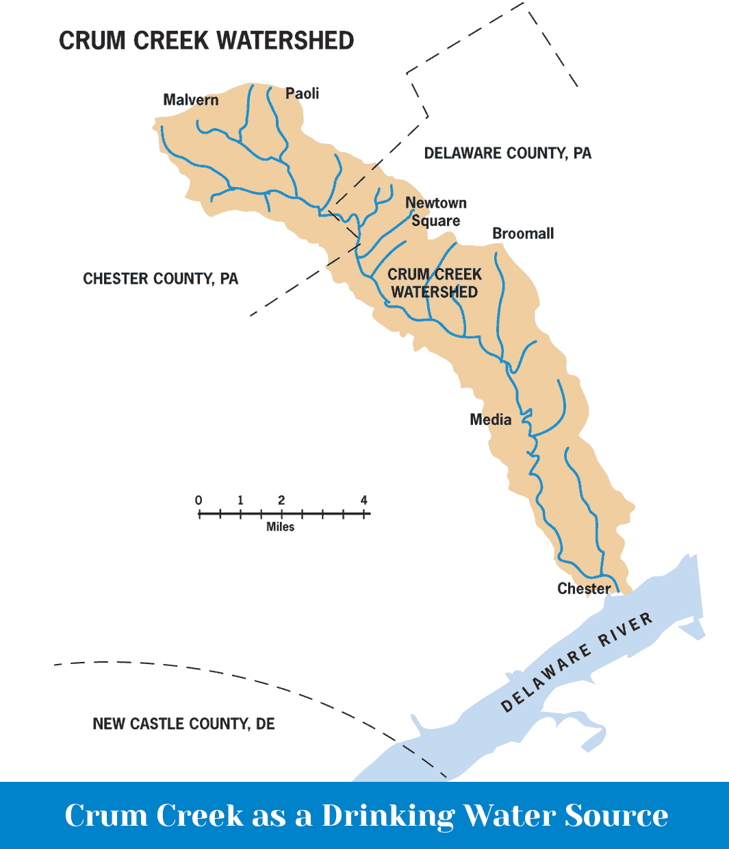
Crum Creek Watershed

Crum Creek, which means "crooked creek" in Dutch, is a Special Protection stream, with the largest Cold Water Fishery and native trout population of our three creeks. It is the largest drinking water source for Delaware County residents. However, this important resource is being threatened by large-scale development and dramatically increased impervious surfaces in the upper watershed, and development of environmentally sensitive lands in the middle and lower watershed. Nearly the entire watershed is listed as impaired by Pennsylvania DEP.
Crum Creek flows 24 miles from the Schuylkill/Delaware drainage ridgeline that follows Monument and King Roads in Malvern and Route 30 in Paoli, through Chester and Delaware Counties to its confluence with the Delaware River in Eddystone at the Boeing plant. The 38 square mile drainage area encompasses 15 municipalities and has a population of approximately 68,000 residents.
CRC’s programs are aimed at addressing these issues and protecting Crum Creek’s critical water resources. By supporting CRC, you are helping to safeguard these resources for your family, community, and future generations.
The central features in the Crum Creek Watershed are the Lower Crum Reservoir, which supplies drinking water for 200,000 Delaware County residents, and the 391 acre Springton Lake Reservoir, created in 1931 by impounding Crum Creek to ensure an adequate drinking water supply to the Lower Reservoir.
The Aqua Pennsylvania drinking water treatment plant on the Lower Crum Reservoir withdraws 19 million gallons per day to provide drinking water. In addition, another 700,000 gallons per day is withdrawn from wells or other surface water intakes.
